


Washington, DC–(ENEWSPF)–June 27, 2016. Nothing is more quintessentially American than the road trip. Each year, millions of people load up their cars and embark on scenic drives through national parks. These roads represent astonishing feats of American engineering, blending the road into the landscape and guiding visitors through some of the most beautiful sights in the nation. They’re also a great option for visitors who may otherwise not be able to access the parks. Some of these scenic roads are very popular, so be sure to get an early start or visit in the middle of the week.
So this year, hit the road, take advantage of the scenic lookouts and pull-offs along the way and immerse yourself in some of the best views this country has to offer.
1. Going-to-the-Sun Road in Glacier National Park
Named after Going-to-the-Sun mountain, Going-to-the-Sun road is one of many beautiful American roads to traverse the Continental Divide. The road is also the first place in the U.S. that was labelled a National Historic Place, National Historic Landmark and Historic Civil Engineering Landmark. It also holds a place in American film history, having appeared in both Forrest Gump and The Shining. Despite being open less than four months of the year (because of snow, it tends to only be open mid-June to early-October), tens of thousands of visitors experience this engineering marvel and see some of the most spectacular scenery Glacier National Park in Montana has to offer. Taking this drive is an experience you’ll never forget.
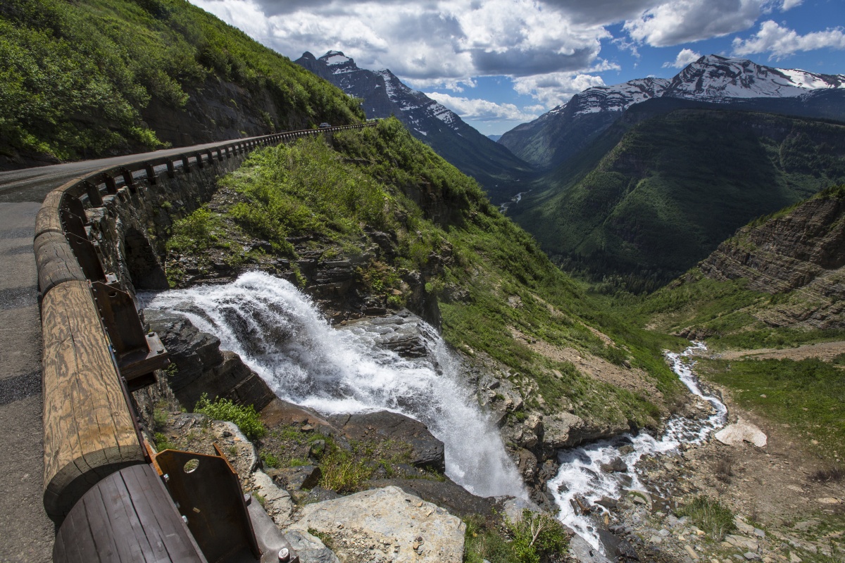
A waterfall rushes down a cascading bed of rocks in Glacier National Park. Photo by Jacob W. Frank, National Park Service.
2. Skyline Drive in Shenandoah National Park
The Appalachian mountains are the dominant feature of the eastern United States and offer some of the most sublime views in the nation. Skyline Drive runs 105 miles through the Blue Ridge Mountains — a southern section of the Appalachians — in Shenandoah National Park in Virginia and is the only public road through the park. Wildflowers carpet the roadside in the spring and the blazing colors of the autumn leaves will mesmerize you. The 35 mph speed limit means that visitors drive at the perfect speed to roll down the windows and let the wind whip through your hair. Animals are also a common sight on the way, with deer, black bears and wild turkeys being just some of the wildlife that are easy to spot from the gentle, curving road. If Skyline Drive leaves you wanting more, travel south and explore Blue Ridge Parkway in Virginia and North Carolina for another amazing mountain cruise.
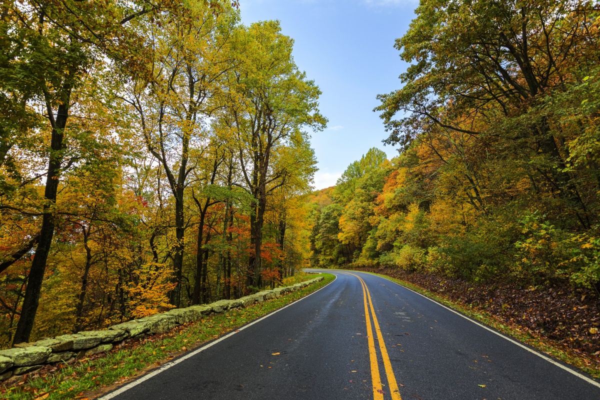
Crisp golden leaves hang from the trees in Shenandoah National Park. Photo by N Lewis, National Park Service.
3. Trail Ridge Road in Rocky Mountain National Park
Designated as an All American Road by the Department of Transportation, Trail Ridge Road crosses from beautiful pine forests to alpine tundra at some of the highest points in Colorado’s Rocky Mountain National Park. The drive is so high, that visitors will climb 4,000 feet in a matter of minutes! Outside of the car, plant and wildlife flourish throughout the drive — moose, bighorn sheep and around 200 species of alpine plants are a few of the amazing sights that you might see on the drive. With a top altitude of over 12,000 feet, slow speeds and deep breaths are recommended.
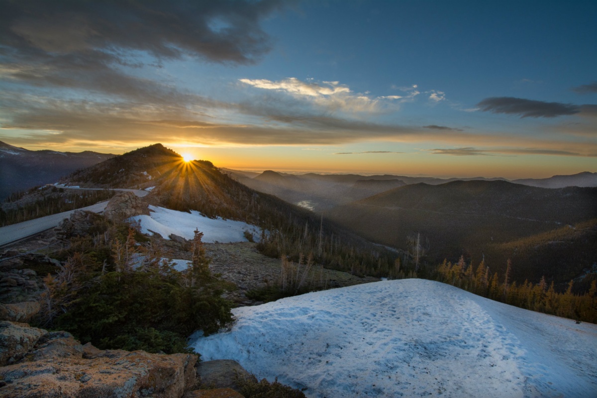
The sun hides behind snowcapped mountains in Rocky Mountain National Park. Photo by Janine Dawley (www.sharetheexperience.org).
4. Zion-Mt. Carmel Highway in Zion National Park
In 1909, Zion was virtually inaccessible to visitors because of poor road conditions in Utah and limited railway. Once Zion became a national park, people wanted to explore it. To make this possible, construction began on a 25-mile stretch of road to connect Zion to the Grand Canyon and Bryce Canyon. Completed in 1930, the Zion-Mt. Carmel Highway and Tunnel is a must see. The 1.1-mile-long tunnel cuts through the vertical sandstone cliffs of Zion, blends in with the surrounding landscape and includes windows to provide views of Zion Canyon. When the tunnel opens up, drivers are left in awe of the spectacular beauty.
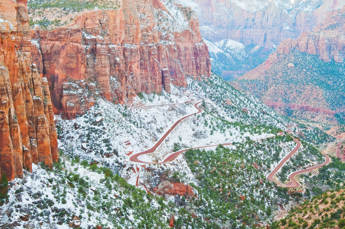
The Zion-Mt. Carmel Highway winds down a canyon and through a sea of snow-capped evergreens. Photo by Sarah Chah (www.sharetheexperience.org).
5. Park Loop Road in Acadia National Park
Roll down the windows, breathe the ocean air and take in the beauty of Acadia National Park from Park Loop Road. This scenic drive is a 27-mile stretch of road that connects the park’s lakes, mountains, forests and coastline. It offers stunning views of the Atlantic Ocean as well as the park’s plant and animal life, giving visitors an intimate introduction to the ecosystem of Maine’s Mount Desert Island. The stunning scenery has long attracted artists, who sought out local fishermen for transportation and rustic housing. The park was created in 1916 and the road was built between the 1920s and the 1950s, with much of the physical labor done by the Civilian Conservation Corps in the 1930s. Their hard work created one of the finest drives on the east coast and one of the best places in the world to see a sunrise.
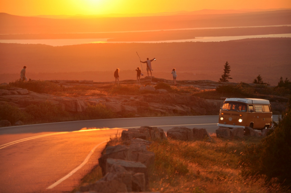
Young people watch the sun set in Acadia National Park. Photo by Jenn Howard (www.sharetheexperience.org).
6. The Racetrack Road in Death Valley National Park
Don’t be fooled by the name — The Racetrack is a 2.8 mile long dry lake, otherwise known as a “playa,” and it is definitely not a speedy drive. Visitors to the Racetrack bounce along the rough road, enjoying epic views of mountains and desert. Driving on the playa itself is not allowed due to its impact on the fragile desert, but if you hike a half mile from the road, you can see the Death Valley’s famous sailing stones. While no one had seen the stones move until 2014, the meandering tracks behind them on the playa’s surface prove that they do indeed slide along the ground. To get there, you’ll need good tires and lots of water, 4×4 and high clearance are usually required. Standard rental vehicles are not recommended, and often get flat tires. Use extreme caution on this road in the summer heat.
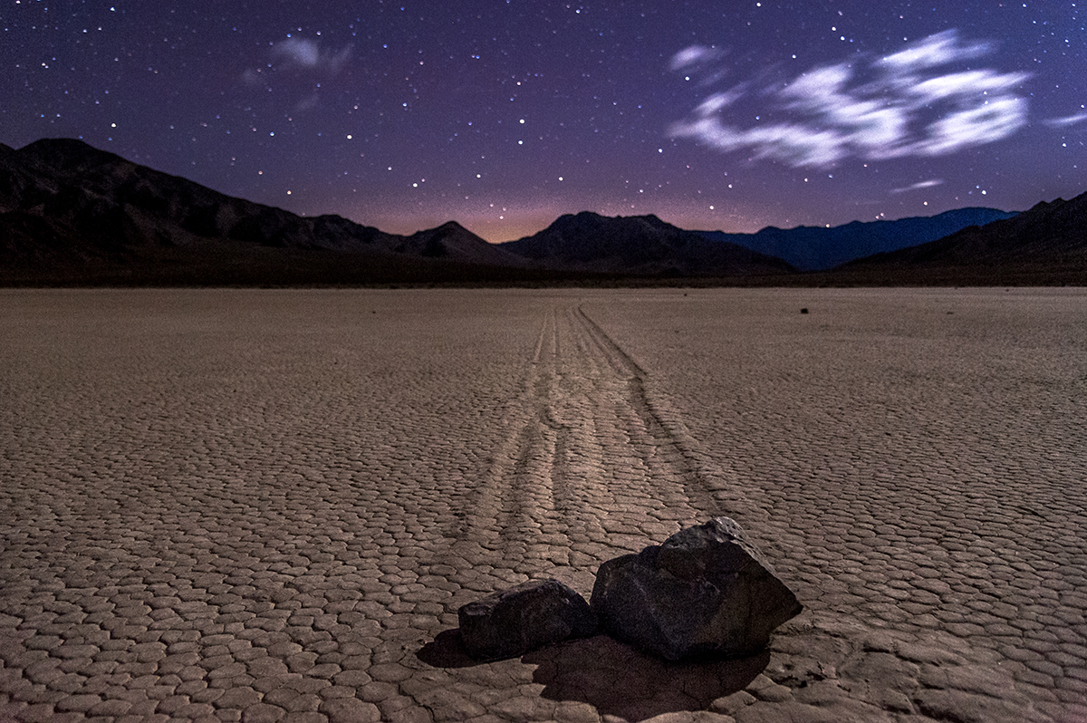
The starry violet sky overlooks famous sailing stones on a dry lake in Death Valley National Park. Photo by Cat Connor (www.sharetheexperience.org).
7. Badlands Loop Road in Badlands National Park
Badlands Loop Road allows visitors to pass through one of the most scenic 31-mile stretches of Badlands National Park. The drive has numerous lookout points where visitors can enjoy views of South Dakota’s famous’ layered rock formations, buttes, cliffs and mixed-grass prairie. The unique landscape was formed by deposits of sediments 69 million years ago when an ancient sea stretched across what is now the Great Plains. After the sea retreated, erosion carved these fascinating formations into the hills. Erosion continues to carve the Badlands buttes today, so hit the road to see this wonder soon.
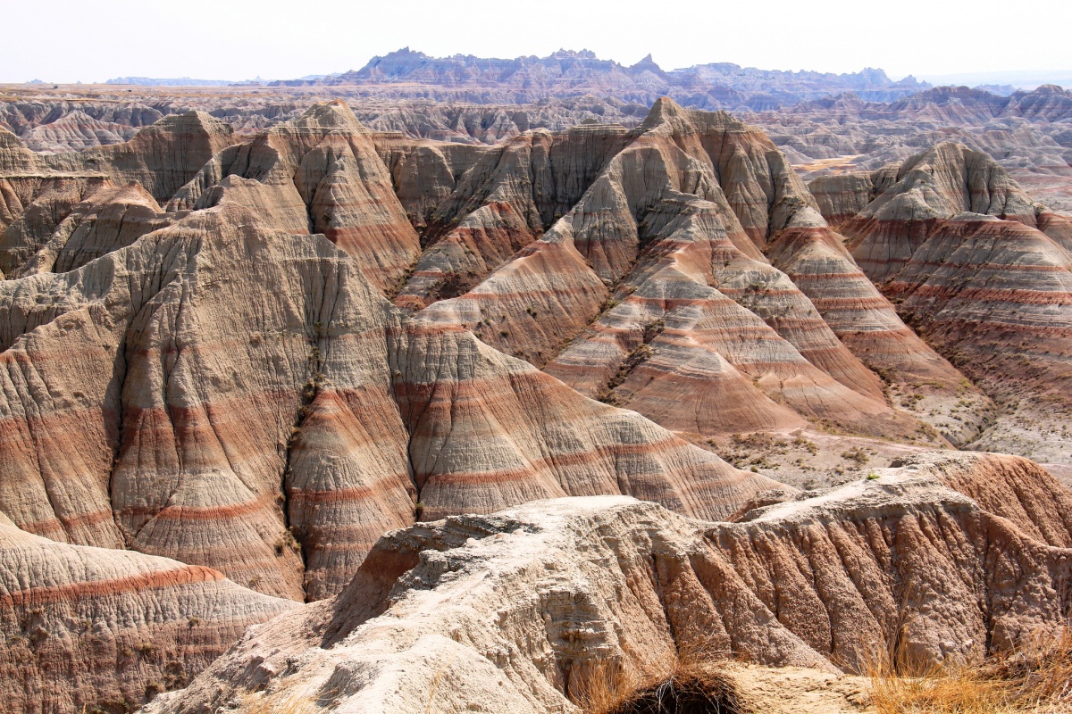
Dusty shades of pink and red swirl around rock formations in Badlands National Park. Photo courtesy of Leo Boudreau.
8. Natchez Trace Parkway
The Natchez Trace Parkway is a 444-mile drive through Alabama, Mississippi and Tennessee. This little-known trail has seen over 10,000 years of human history. The most celebrated travelers of the Natchez Trace were farmers and boatmen from the Ohio River regions of Pennsylvania, Ohio, and Kentucky — floating supplies down to ports in Natchez and New Orleans at the beginning of the 1800s. Before that, the Trace was a major trail through Choctaw and Chickasaw country. It also ran through a series of mounds that had been built by people over the previous 2000 years. Today, the trail is accessible for visitors in vehicles as well as hikers, cyclists, horseback riders and campers. Don’t forget to stop at some of the parkway’s many pull-offs and explore the natural and cultural treasures protected here.
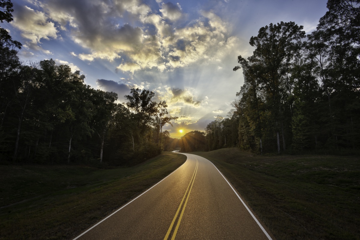
The sun triumphantly rises over Natchez Trace Parkway. Photo courtesy of Marc Muench.
Source: http://www.doi.gov


